|
|
Key West All Time Record Hail
April 27, 2003
|
|
|
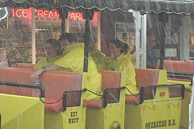
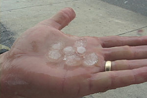
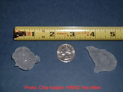
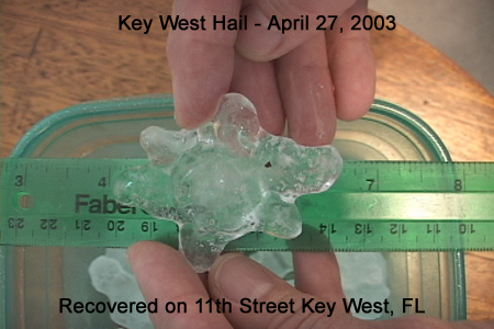
"The Conch Tour Train ride from Hail" is the title of this image. At precisely 3:58:32pm local time these tourist realized that it is starting to hail. (Click on images for a blowup). While thehail I saw was not the 1.75 inch size reported near the airport by the Key West Weather Service Office (WSO), it definitely had folks running for cover. This was one of many Conch Tour Trains caught in the surprise afternoonhail storm that set a record for largest hail in Key West since records have been kept at the Weather Service Office. The image of the hail on the far right was supplied by Chip Kasper of the WSO. The quick thinking meteorologistquickly set up a shot with a tape measure and quarter for scale. That piece on the right looks about 1.5 incheslong. Wow! Hail is very rare in Key West and 1.75 inch ice is extremely rare. So I thought the 1.75 inch hail was tops . . . that was until the local Key
West paper Solares Hill came out with a photo showing even bigger hail. I called the editor Mark Howell and he let
me use the photo of hail that fell down on near 11th Street in Key West taken by Barbara Durland. Mark and his
wife Jan wisely collected the hail and |
|
|
|
My day started at 4:30am with a schedule shoot for a client. I headed
down to the upper deck of the historicLa Concha Motel for a few aerials shots then quickly moved to the famous
lighthouse down the street. Next up was the beach on the south side of the Island where I filmed people
running. I got the video uplink taken care of and
headed back home. I headed back down to Key West with all my gear. About 6 miles out I pulled up the local doppler radar using Rory Groves' SWIFT weather program. I had the image in 2 minutes from the time I initiated the cell phone call.Boy, that was fast. I saw a multicolored cell just west of Key West. Heck, at 6 miles out I could see the rain shafts in the distance. Looks like I was getting the set up I've always wanted: To be on Duval Street when the heavens opened up and all the tourist scatter like mice! The money shot! I went the fast route to Duval Street the tourist don't know about.
Unfortunately I didn't want to screw around
looking for a parking place so I paid the $15 to park at a pub called "Hog's
Breath". I know, nobody pays $15
for parking but it was a great location. I grabbed the gear and made a
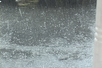
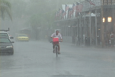
"B-Line" for a big intersection at the north end of Duval Street. My timing was perfect because it just started
sprinkling. These Key West tourist are a prettyhardy bunch and they just ignored the light rain, that is until the lightning started
landing nearby and the rain went into
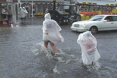
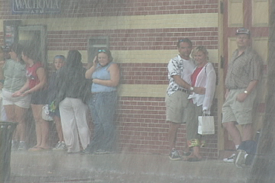
gully washer mode. That did the trick. Every direction I pointed the
camera there were people scrambling for cover. |
|
|
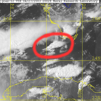
| The storm was short lived and lasted less than an hour. The above images show how easily the Duval Street areacan flood so quickly. Here is a CONUS image from NRL Monteray and a skew t/Log p graph. |
|
|
Back to Home Page ExtremeStorms.com